
The Cetina River is a majestic waterway flowing through Croatia’s Dalmatian hinterland. Known for its dramatic gorges, waterfalls, and fertile valleys, it has long sustained life in this rugged region—and today draws adventurers and nature lovers alike.
Table of Contents
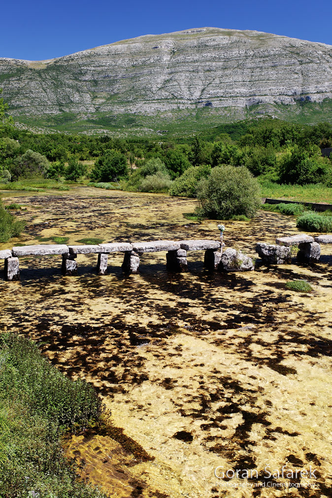
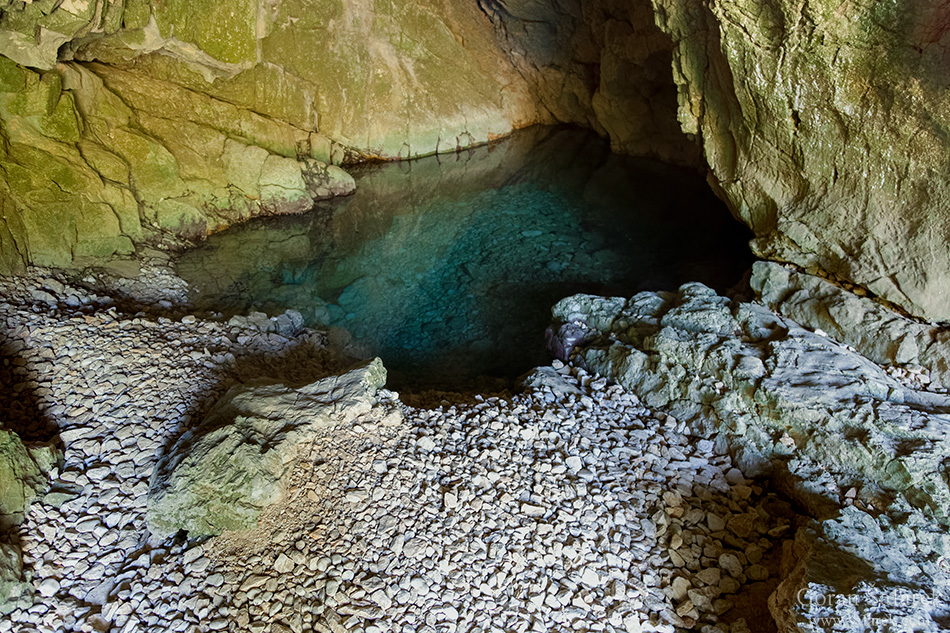
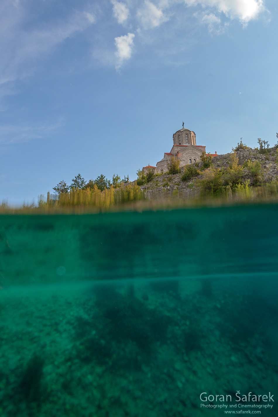
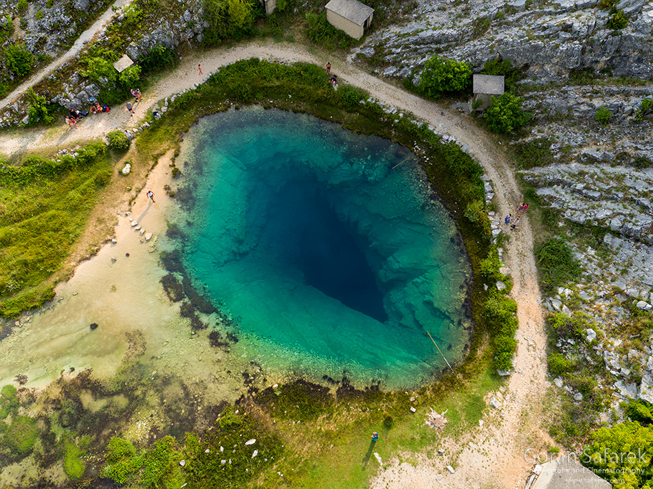
Unlike many of Croatia’s rivers, Cetina doesn’t hide its source in the dark of a deep canyon beneath steep and inaccessible cliffs, nor in the shade of tall fir trees or in a secret cave. Quite the contrary, the turquoise eye of the spring of Cetina adorns quite uniquely the barren rocky karst environment surrounding it, boldly spitting ice-cold water onto the surface. Not far from here, there’s the Church of Holy Salvation, which dates from the 9th century and is one of the most outstanding Old Croatian sacral structures.
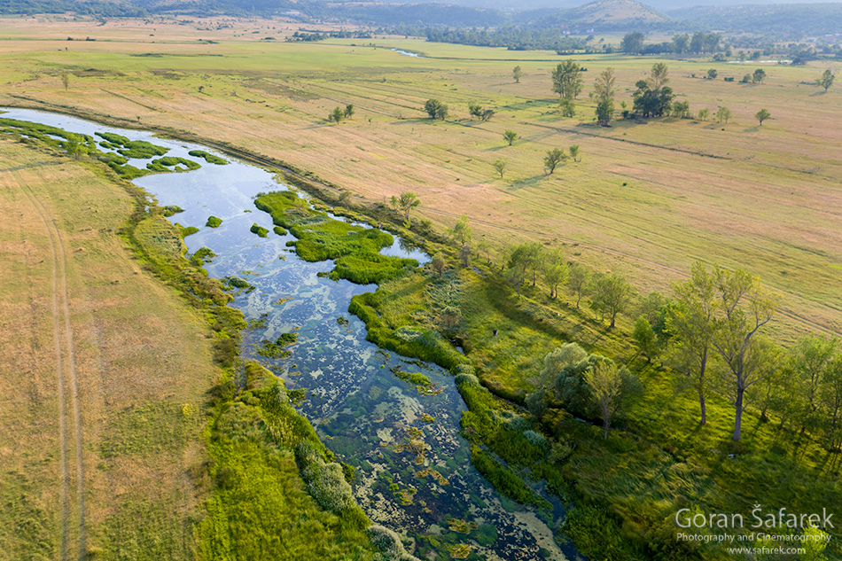
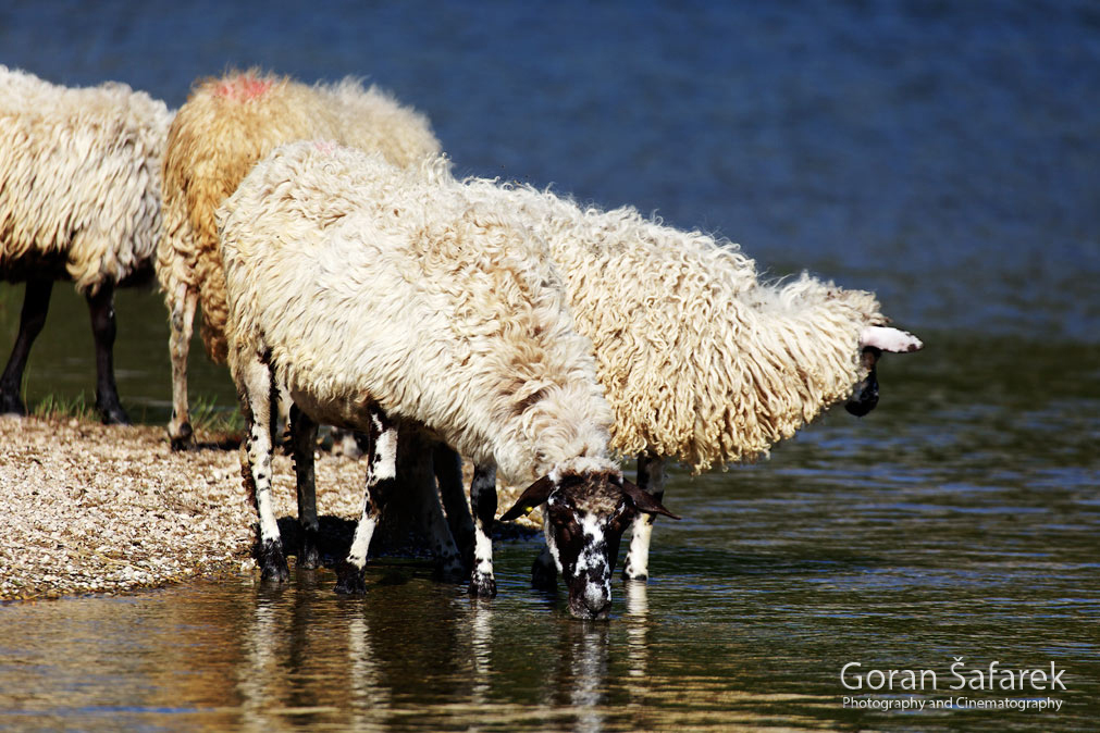
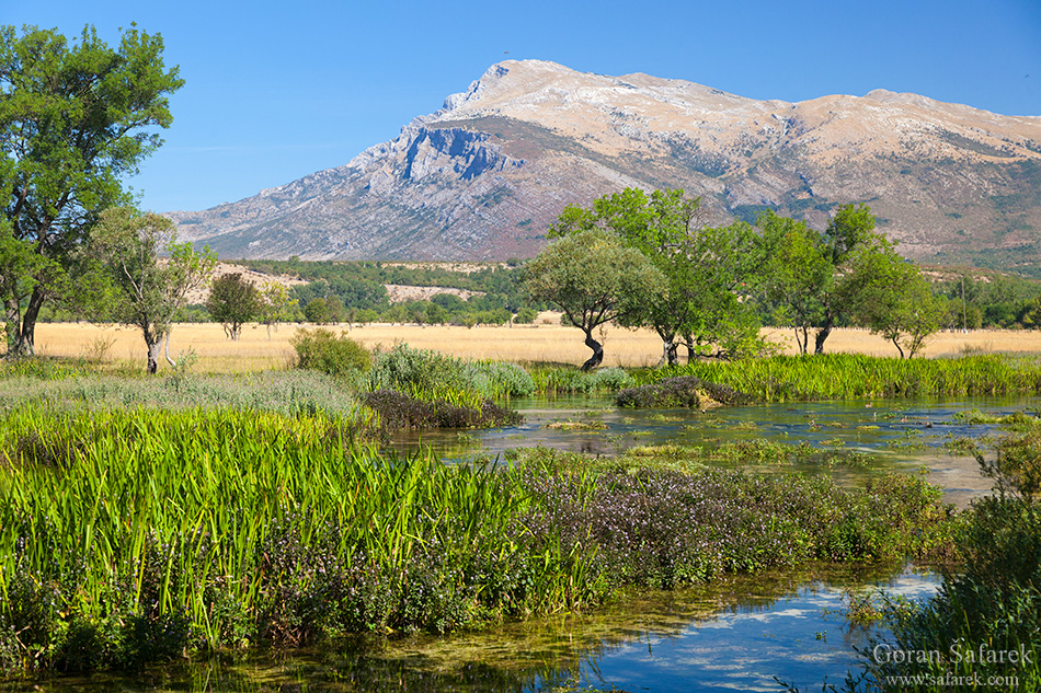
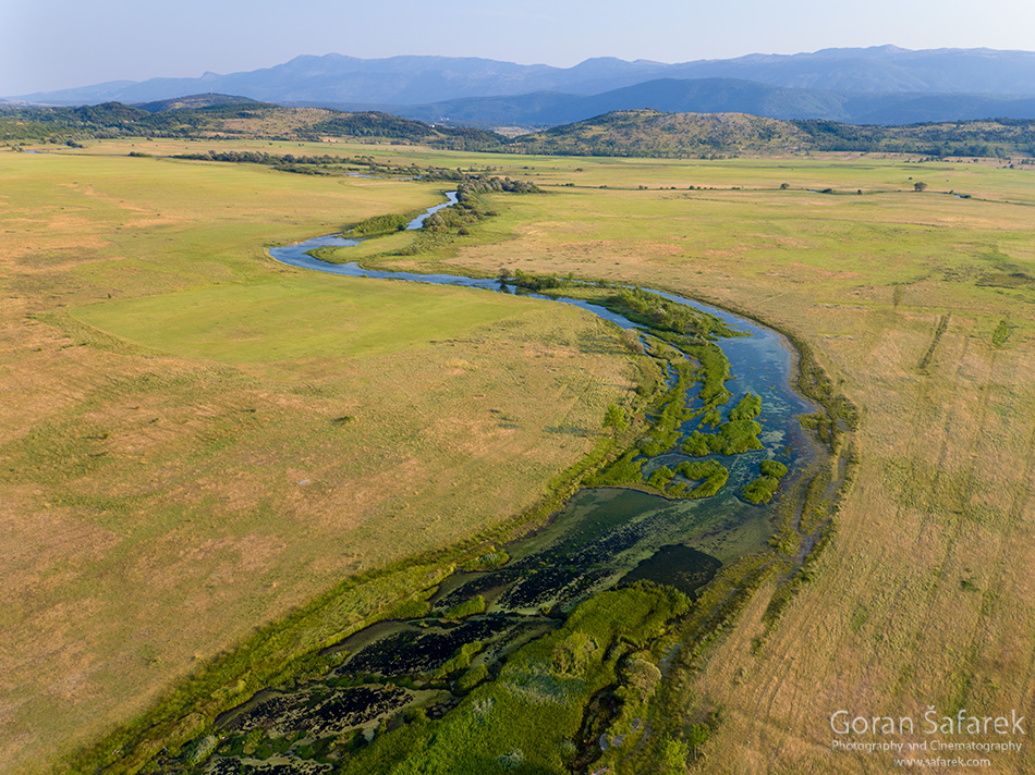
Cetina gurgles from its source beneath the magnificent massif of Dinara and Kamešnica. Here lies a series of flat karst plains that Cetina once flowed across in the upper part of its course. The plains are broken up by short and narrow gorges. Thanks to the greenish Cetina winding through tall yellow grass, refreshing large flocks of sheep by quenching their thirst, Cetina’s picturesque plain, also known as Paško Polje, reminds of the African savannah in the summer.
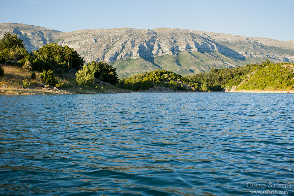
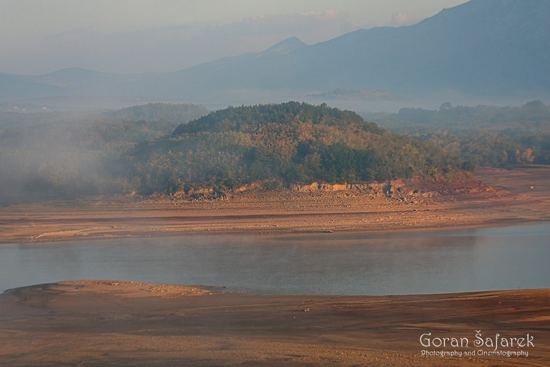
At one point, these idyllic plains transform into the first in a series of reservoirs – the Peruća Lake. Significant amounts of water flow into the reservoir from the mountains of south-western Bosnia, making it an abundant source of water even in the most severe of droughts. This makes it very suitable for hydropower exploitation, which has in turn resulted in the look of the river today having been changed significantly. However, its victims are fertile fields and villages. Cetina re-emerges at the end of the canyon of Peruća Lake near the town of Panj, where it flows beneath the oldest existing bridge across Cetina made of stone. From here, Cetina passes through the flatlands of the Dalmatian hinterland.
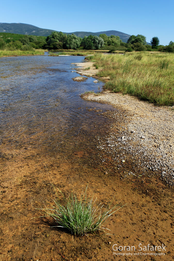
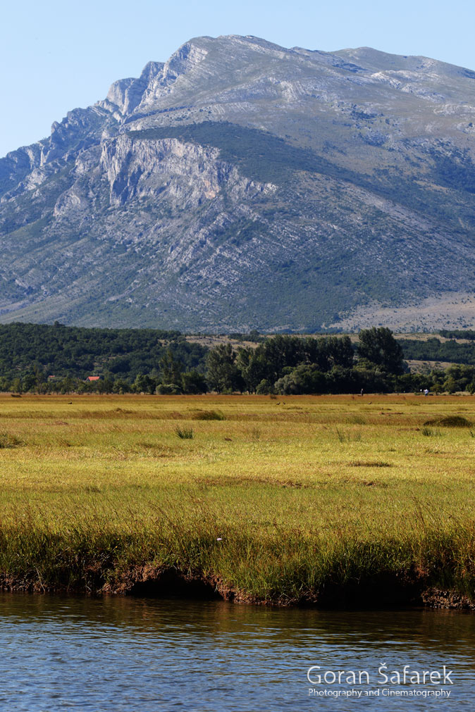
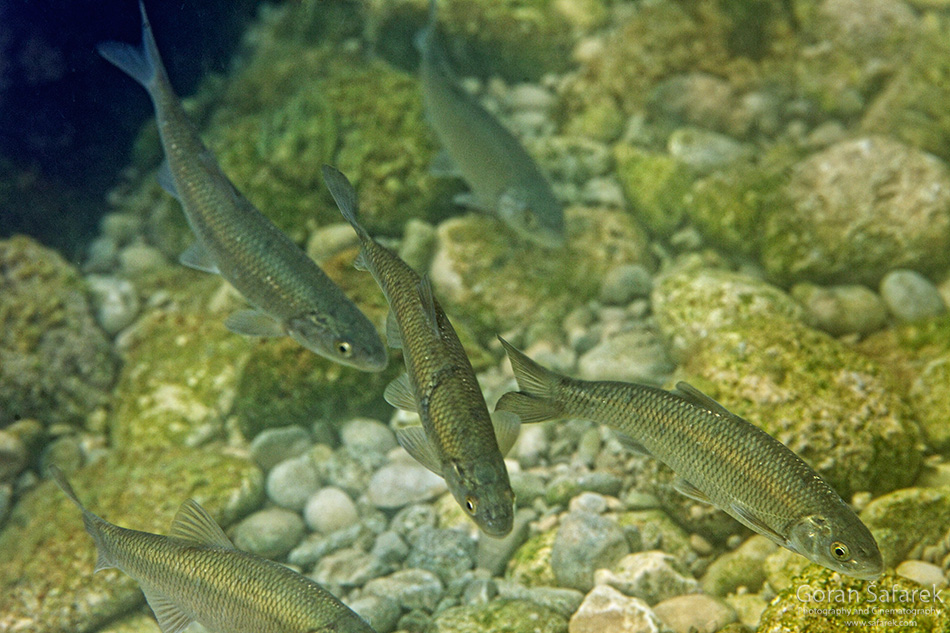
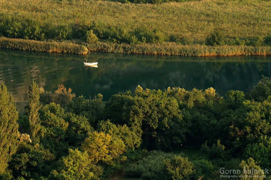
Thanks to an abundance of arable land and water, people have been settling here since ancient times. Sinjsko Polje is a vast plain interspersed with golden fields of corn and wheat, into which many amelioration canals have been dug from Cetina. In fact, here, in its lowland landscape, Cetina resembles a large lowland river: shingle river beaches and branches, backwaters filled to overflowing with wetland plants, riversides overgrown with willow shrubs and poplar trees. But Cetina’s crystal clear, ice-cold water and the rocky slopes of high mountains in the distance clearly distinguish Cetina from the flatlands of Slavonia.
The many archaeological sites along the entire watercourse of Cetina in general and in Sinjsko Polje, in particular, are proof that the Cetina River has been a real boon to life since prehistoric times. That the Illyrian tribe of Delmata had settled here is read from the countless records left behind by the mighty Roman Empire.
It is estimated that the Roman Tilurium Camp in the present-day village of Gardun near Trilj could accommodate five to six thousand soldiers, making it the second-largest military stronghold in the Roman province of Dalmatia (the largest one is the Burnum Military Camp on the Krka River), which covered the entire region of the Dinaric Alps.
Besides irrigation, Cetina also provided energy for the grinding of grain and timber. Its waterfalls were once spotted with large, high-capacity powerful mills built here of carefully selected and chiseled stone, the kind rarely found on Croatia’s other rivers, which is but further proof of the fertility of the region. Along its entire watercourse, several short yet mighty tributaries flow into Cetina, one of which is Rumin, Cetina’s left tributary. Unlike Cetina, whose riversides are low, plowed over or turned into pastures, Rumin’s source is tucked away deep into karst canyons. There are also the rivers of Grab and Ruda.
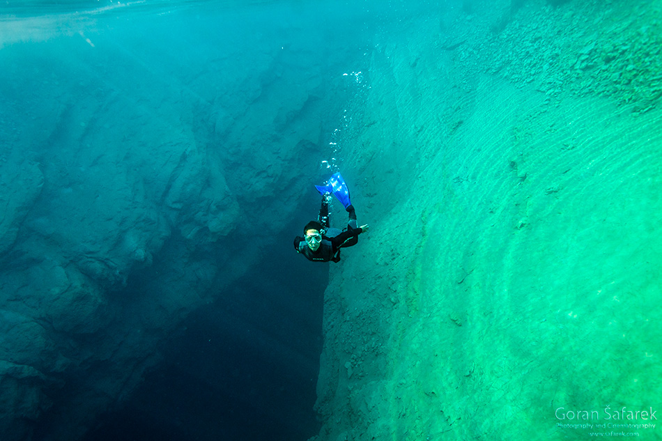
See the canyoning on the Cetina River, also a rafting guide in Croatia.
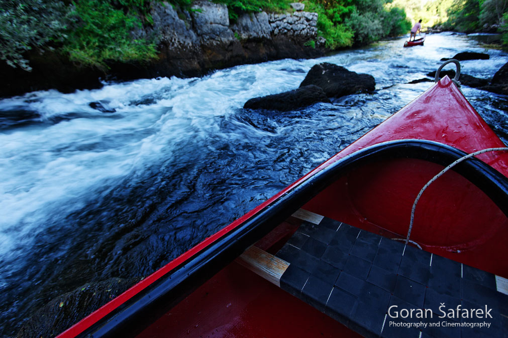
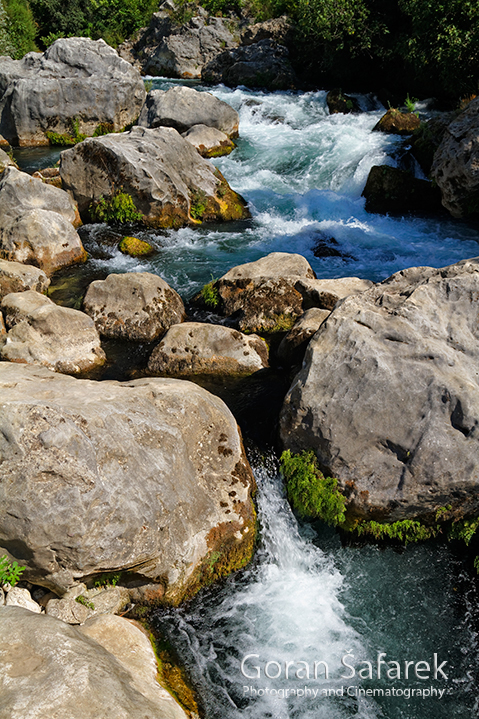
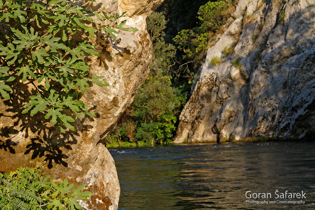
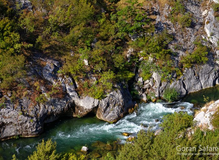
From the bridge across Čikotina Lađa, the Cetina enters a canyon which flows through all the way to its mouth. Cramped in a narrow canyon, the water foams between and around boulders that rolled off the slopes of the canyon. One after the other, rapids thread their way through the canyon, with Cetina’s calmer parts interlacing them only here and there. With the exception of canoe tours, accessing and touring this part of Cetina’s canyon is next to impossible.
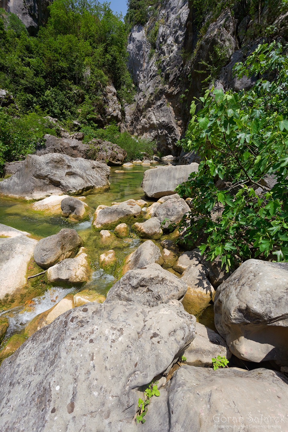
Blato (mud in translation) on the Cetina River is but a tiny widening in the river boasting a bit of arable land on its banks, which is why a settlement of the same name is found here. Downstream, Cetina continues to flow in an approximately two-hundred-meter deep canyon wedged into a karst plateau. Resembling vertical monolithic walls, the cliffs here drop directly into the riverbed, with the canyon narrowing in places to only a few meters in width.
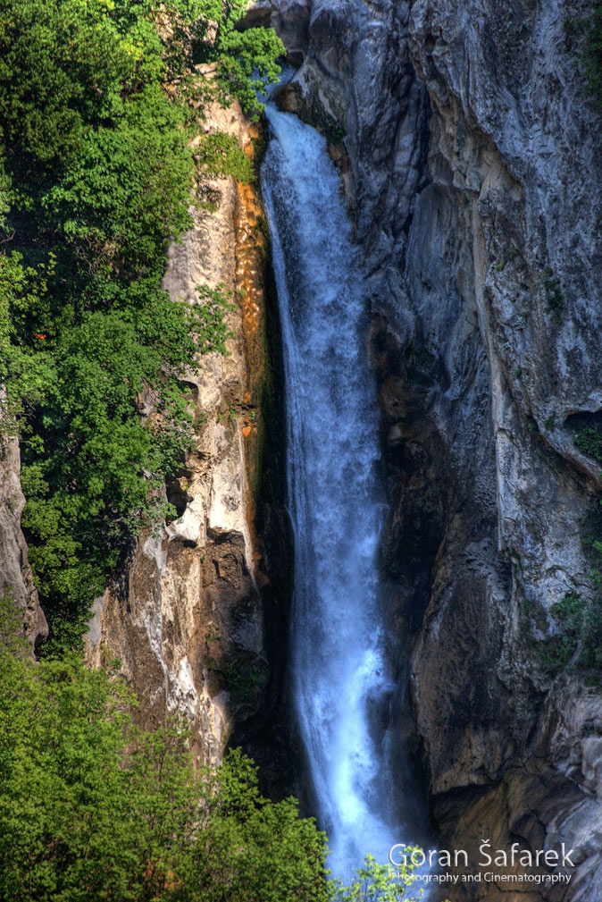
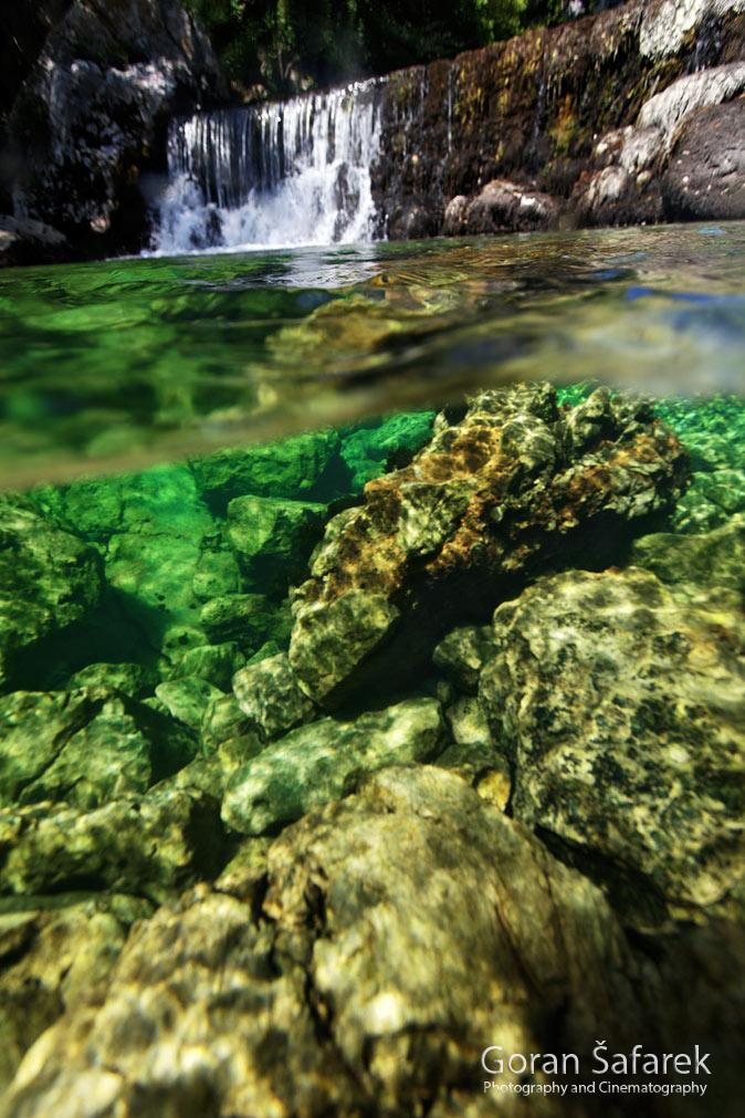
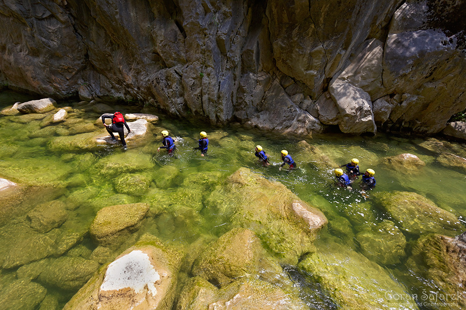
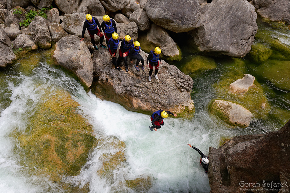
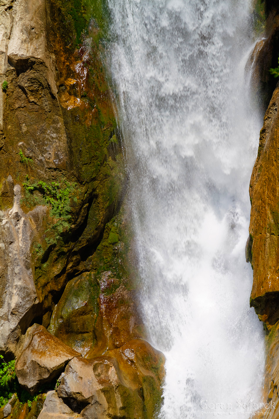
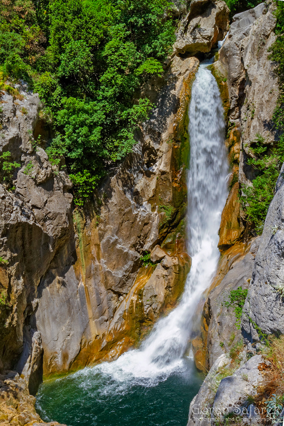
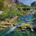
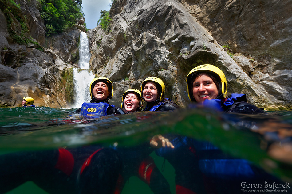
The highlight of the canyon is a fifty-meter waterfall called Gubavica. It’s awe-inspiring, particularly in the rainy season when considerable amounts of water flow through the canyon. During the rains, the water crashes into the crater of the canyon not only down its two main waterfall cascades, but also from the circular holes in the rock on its sides.
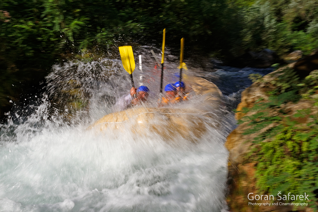
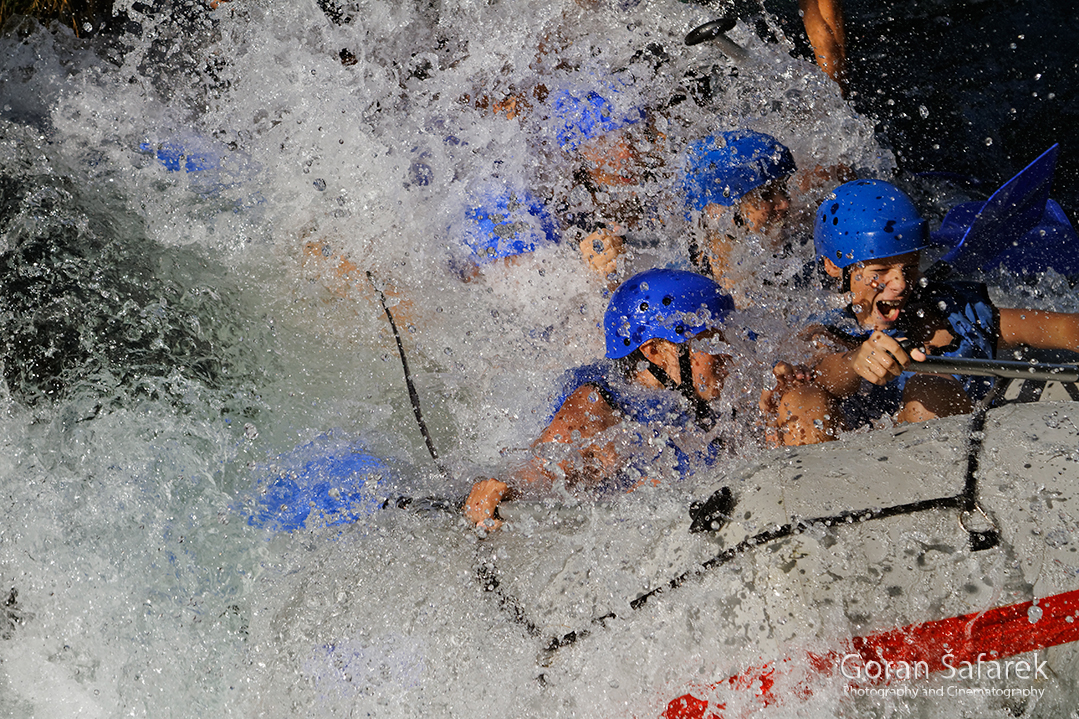
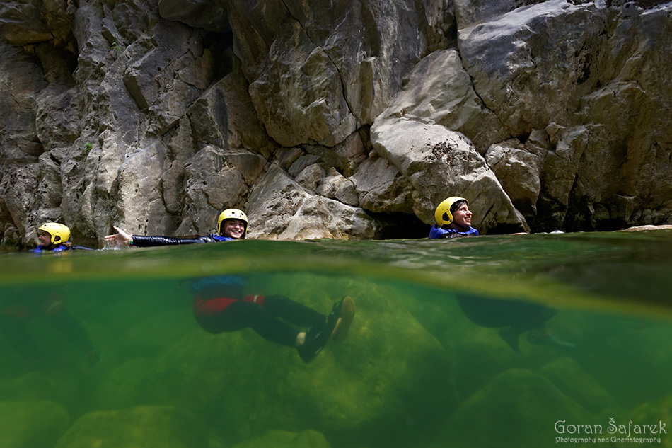
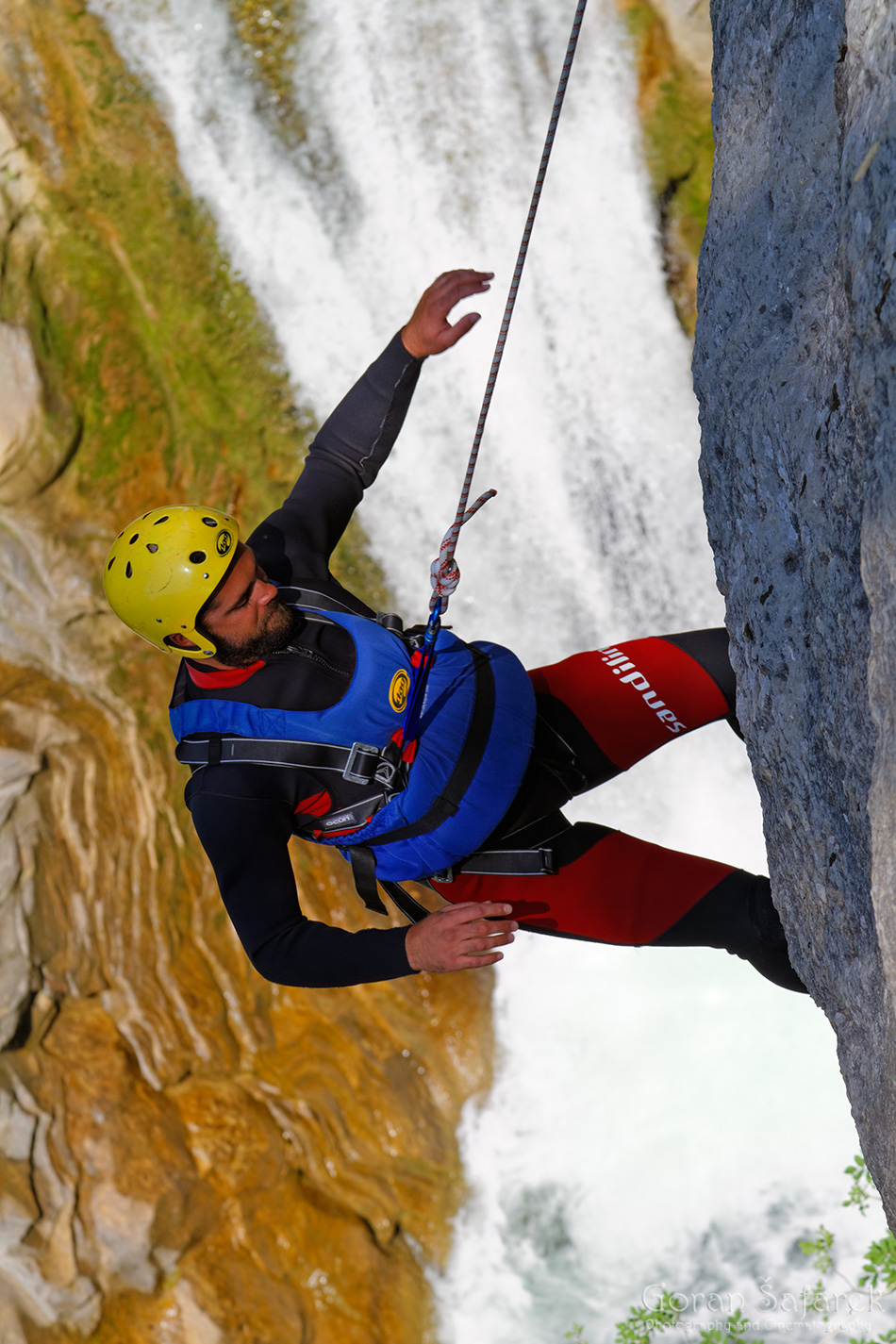
The entire canyon is sprayed with trillions of tiny water droplets and filled with a deafening rumble. In the summer, the waterfalls are slender and elegant, with columns of curious adventure seekers − dressed in wetsuits and wearing life jackets and safety helmets − exploring and touring the canyon and conquering the waterfalls with the help of climbing ropes. Canyoning on the Cetina River has become a major attraction.
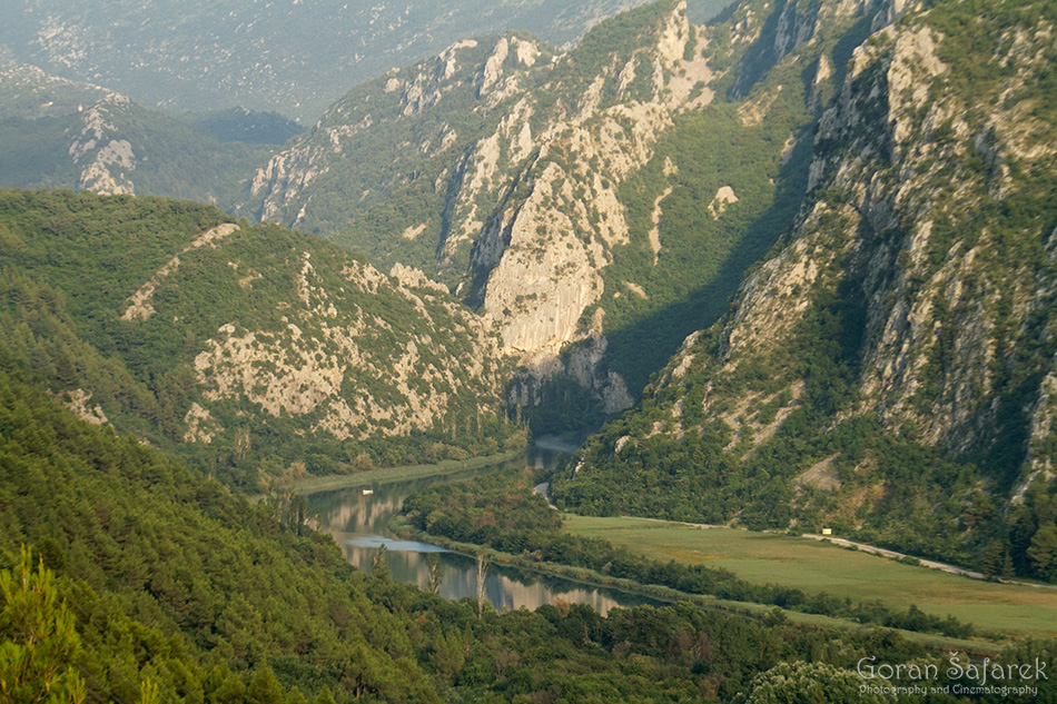
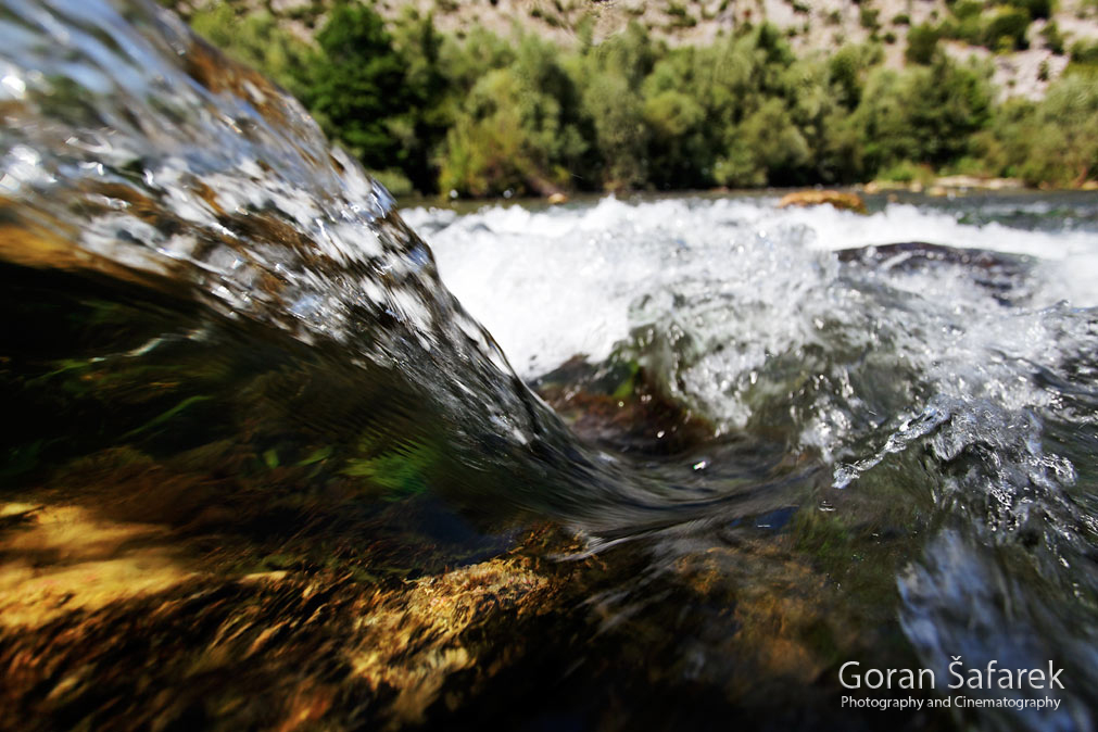
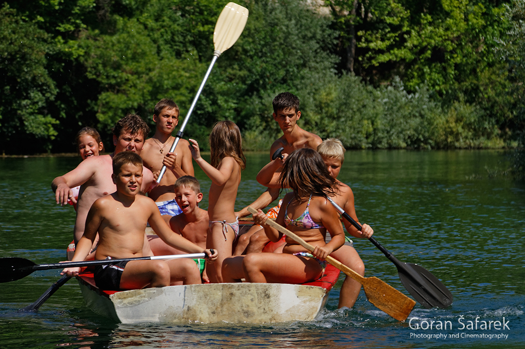
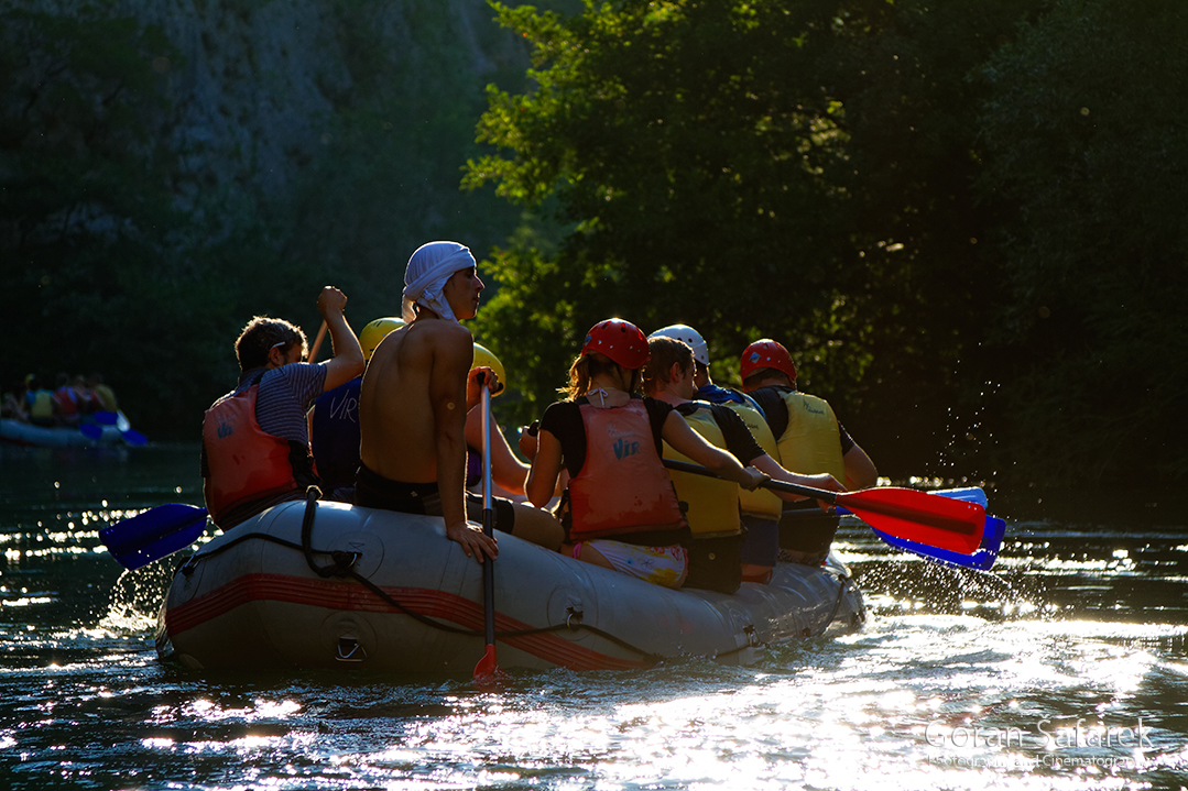
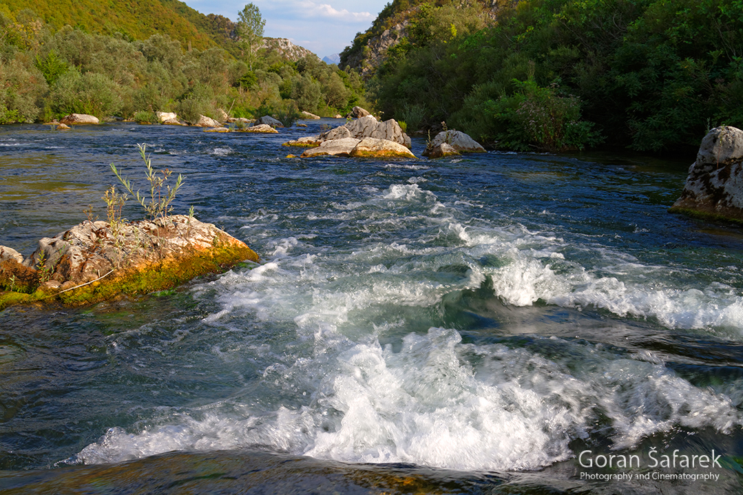
At Zadvarje, Cetina turns west towards the Adriatic Sea. Having freed itself from the tight canyon of Gubavica, it slows down a bit spreading out across the valley. Up to its mouth, narrow gorges and canyons alternate with widenings and smaller river valleys. In peak season, this part of the river is swamped with thousands of tourists in rubber dinghies, bouncing on and against Cetina’s waves. Touristically speaking, this is the liveliest part of the river. The dangerous Oblačnik rapid was created by heaping the riverbed with giant stone blocks; tourists bypass it by squeezing through a cave created under the Studenac Waterfall, while their skippers paddle down the rapid safely in empty rafts.

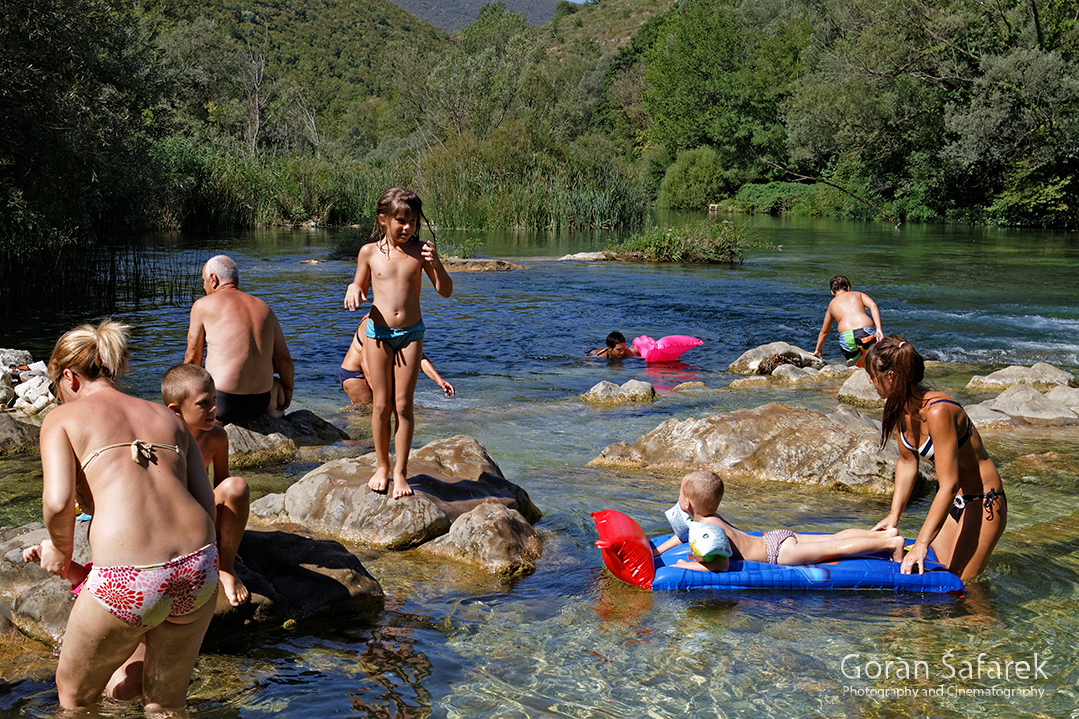
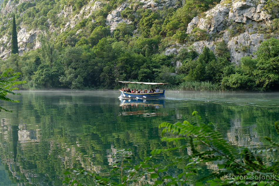
The mills at the spot where Cetina leaves the canyon and calms down date back to the 17th century. They enjoyed a boom in the 19th century after they were taken over and completely renovated by the Radman family, whom they were named after, including the widely known Radman’s Mills restaurant. From here all the way to Omiš, slow tourist boats sail along what is now dead calm Cetina.
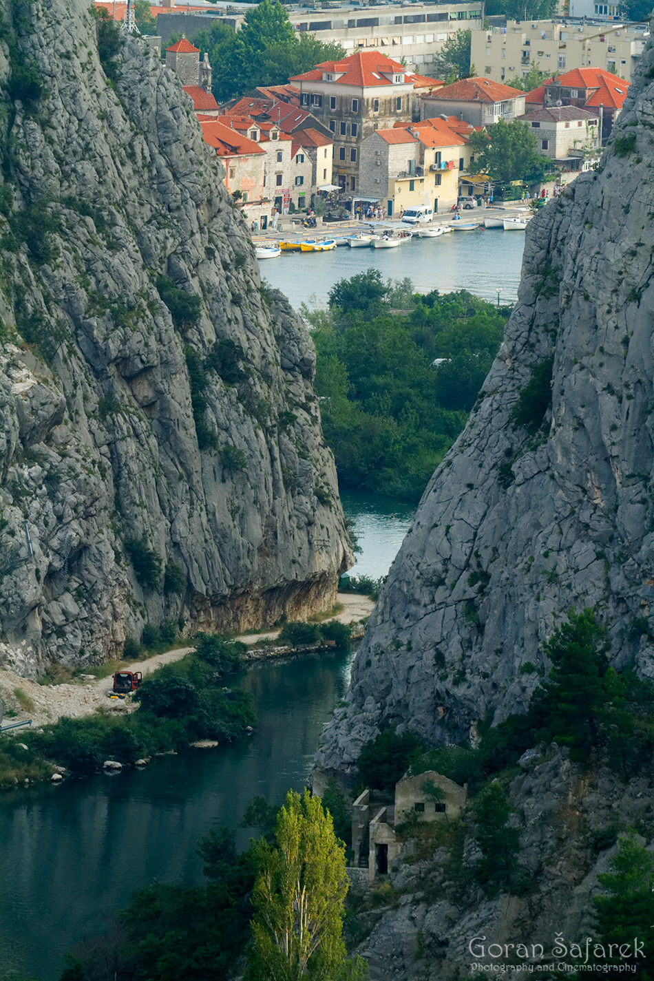
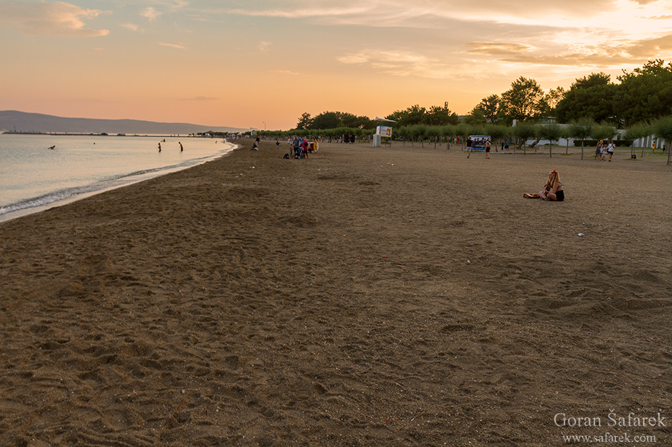
This small Dalmatian town with a long and turbulent history is located on the east riverside of Cetina’s estuary. The Cetina River and its estuary wedged in between the slopes of Omiška Dinara and Mosor have provided Omiš with safety and protection throughout history. Today, Cetina continues to be exceptionally important for the entire region of Dalmatia both as a gem of nature and a tourist destination.
See more pictures in the gallery: